High-Tech Agriculture: What AI and Satellite Monitoring Mean for Philippine Farms and Food Security
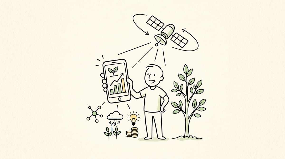
The Department of Agriculture (DA) and the Philippine Space Agency (PhilSA) have partnered to modernize Philippine farm data monitoring using artificial intelligence (AI) and satellite technology. Announced on September 17, 2026, this initiative aims to provide accurate, real-time insights into crop health, water resources, and natural disaster impacts nationwide. For ordinary Filipino households, improved farm tracking can help stabilize food prices, protect agricultural supply chains against severe weather, and aid long-term climate planning. While tech literacy remain a barrier for small-scale farmers, this high-tech shift represents a vital step toward long-term national food security.
Eyeing 30% Yield Boost: Philippines Deploys AI Satellites to Map 4.8 Million Hectares of Farmland
"Integrating AI algorithms with satellite remote sensing eliminates guesswork in food security planning, shielding localized supply chains from severe weather disruptions."
On September 17, 2026, the Department of Agriculture (DA) and the Philippine Space Agency (PhilSA) formally announced a strategic partnership to integrate artificial intelligence (AI) and satellite imagery into national agricultural monitoring.
Under this initiative, satellite data combined with AI processing will monitor crop conditions, map irrigation resources, estimate yield outputs, and rapidly assess farm damage following natural disasters like typhoons and droughts.
Why It Matters
For decades, Philippine agricultural data collection relied heavily on manual ground reporting—a process often delayed by logistics, rough terrain, or severe weather. Slow data collection makes it difficult to predict crop shortages, allocate emergency aid to damaged farms, or manage national food reserves efficiently.
By leveraging remote sensing and automated data processing, public agencies can spot agricultural issues before they escalate into full-blown supply crises.
What the Headlines Don't Explain
While high-tech monitoring sounds like an immediate solution to agricultural challenges, space technology alone cannot plant crops or fix logistics.
- The Ground Reality: Satellite imagery can identify a drought-stricken farm or a flooded field, but addressing those issues still requires working irrigation systems, farm-to-market roads, post-harvest facilities, and direct government support.
- Data Accessibility: Raw satellite data must be converted into simple, actionable advisories that local government units (LGUs) and field technicians can easily interpret and share with farm workers.
- The Digital Literacy Gap: Small-scale smallholders and rural farming communities often lack stable internet access, smartphones, or digital training. If insights remain confined to high-level government offices, the benefits will not reach the ground where they are needed most.
How This Could Affect Filipinos
- Filipino Families and Consumers: More accurate yield forecasting helps government agencies and supply networks manage food imports and local inventory better, reducing sudden price spikes in essential commodities like rice, corn, and vegetables.
- Farmers and Agricultural Workers: Faster disaster damage assessments mean local government units and agricultural offices can deploy relief funds, seeds, and emergency assistance quicker after major storms.
- Rural Communities: Better water resource mapping allows for smarter irrigation planning. During flood seasons, satellite data can help identify excess surface water that can be redirected or stored for use during dry spells or El Niño events.
What People Should Know
Satellite and AI monitoring is a tool for planning and risk management, not a direct financial subsidy or a guarantee of lower food prices tomorrow.
High-tech agricultural tracking provides macro-level oversight. Its real value depends on how effectively local agricultural officers turn data into on-the-ground solutions—such as distributing drought-resistant seeds early or repairing damaged irrigation canals before a harvest fails.
Practical Takeaways
- For Farming Communities: Stay connected with local Municipal Agriculture Offices (MAO) to receive early weather, pest, and crop advisories derived from national satellite tracking.
- For Small Food Businesses and Households: Keep track of official DA harvest projections. Understanding upcoming seasonal yields can help small food vendors budget inventory and hedge against sudden price swings.
- For Local Civic Leaders: Encourage community digital literacy. Building basic digital skills ensures local farming groups can access, understand, and use public agricultural data platforms.
What Happens Next
The DA and PhilSA will focus on rolling out baseline satellite mapping systems and training regional agricultural staff to use AI-driven data tools. Key milestones to watch include:
- The speed of crop damage reporting during the upcoming typhoon season.
- How satellite mapping gets integrated into national irrigation expansion plans.
- Public access to simplified crop condition reports for local farmers and cooperatives.
Modernizing agricultural tracking through satellite imagery and AI is a long-overdue step toward safeguarding the Philippine food supply against climate volatility. While technology cannot replace physical infrastructure or direct farmer assistance, cleaner data provides a stronger foundation for smart policy and timely intervention. Building a resilient nation requires pairing advanced technology with grassroots support—ensuring that every community, from rural farms to urban neighborhoods, benefits from a stable, accessible food supply.

Power Our Mission, Shape the Future
We empower single parents, PWDs, youths, seniors, and stay-at-home parents through digital livelihood.
Help us build resilient communities.
BUKLURAN remains open to partnerships, sponsorships, and collaborative initiatives that create meaningful community impact.
Whether through funding, in-kind support, volunteerism, or shared services, your organization can help strengthen programs that serve underserved communities.
Do you want to take part in our free livelihood programs, scholarship assistance, and community resource pooling initiatives? Membership is completely free.
Join BUKLURAN!
Register, volunteer, and become a member today.