When the Sky Protects the Ground: Why Space Pacts Matter in the Middle of a Typhoon
When the Philippines signs a space pact with Japan, it is not just about astronauts—it is about tracking the next big storm heading for your hometown.
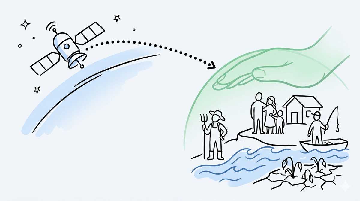
The recent space cooperation agreement between the Philippines and Japan directly impacts local disaster response, farming, and community safety by translating high-altitude satellite data into life-saving ground coordination.
When we hear about space agreements, global satellite missions, or orbital partnerships, our minds tend to drift toward science fiction. We think of astronauts drifting through zero gravity, massive rockets blasting off into the atmosphere, or billionaire tech icons funding deep-space exploration. It feels exciting, but completely disconnected from the everyday realities of ordinary Filipinos. For a family packing an emergency bag as floodwaters rise in a low-lying coastal barangay, or a farmer staring up at an unusually dry sky in Central Luzon, "space" sounds like a luxury meant for wealthier nations.
But space technology is not nearly as distant as it seems. In fact, it is quietly operating in the background of our most vulnerable moments.
Moving Past the Sci-Fi Headlines
In late May 2026, the Philippines and Japan officially signed a Joint Declaration of Interest to advance their bilateral space collaboration. The agreement was inked by the Philippine Space Agency (PhilSA) and the Japan Aerospace Exploration Agency (JAXA). The timing is symbolic, marking the tenth anniversary of the launch of Diwata-1—the historic microsatellite built by Filipino engineers that originally laid the foundation for our national space program.
On paper, this new pact outlines grand, high-level ambitions. PhilSA and JAXA intend to explore joint satellite missions, human spaceflight and exploration, data applications, and the sustainable use of outer space.
Yet, for an intelligent but busy citizen, the real question remains: Why should an ordinary Filipino care about this?
The answer lies not in the stars, but right back down on our soil. When we strip away the institutional jargon, this agreement is fundamentally about building an eye in the sky that can see what we cannot, providing the vital foresight required to protect lives, livelihoods, and local communities.
The Practical View from 600 Kilometers Up
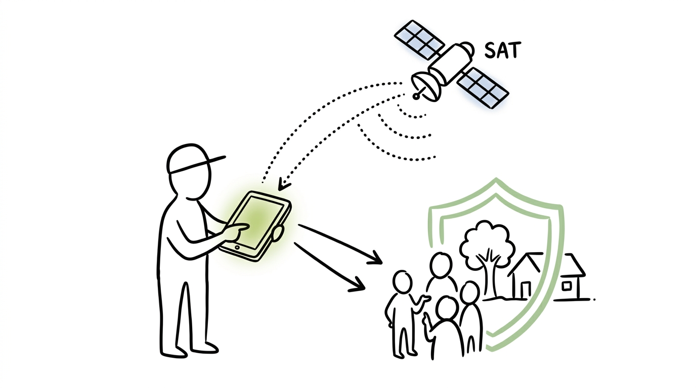
The true value of space science for a developing nation like the Philippines is almost entirely about earth observation and data application. Satellites orbiting hundreds of kilometers above us can capture macro-level changes across our archipelago that are invisible from the ground. When converted into usable data, this aerial view serves three immediate, everyday functions:
- Disaster Mapping: Seeing exactly where rivers are breaching their banks in real time, allowing rescue teams to deploy boats to the correct neighborhoods before local communication networks completely collapse.
- Agricultural Foresight: Analyzing soil moisture levels and vegetation health across entire provinces, giving farmers early warning signs of an impending drought or pest infestation before crops begin to fail.
- Environmental Protection: Pinpointing illegal logging in dense mountain ranges or tracking marine oil spills before toxic sludge washes ashore on local fishing communities.
Without this technology, local governments are forced to fly blind, reacting to crises only after the damage has already occurred. Space collaboration is essentially a way to buy back precious time.
Translating Satellite Data to Everyday Realities
To understand how this looks in practice, we only need to look at an existing international framework highlighted by the new pact: Sentinel Asia. Led by JAXA and the Asian Disaster Reduction Center, Sentinel Asia is an international cooperation project designed to provide satellite imagery to Asia-Pacific nations during major emergencies.
When a severe typhoon hits the Philippines, our local infrastructure is frequently overwhelmed. Cell towers topple, roads wash away, and local authorities lose the ability to see the full scope of the devastation. This is precisely when our agencies step in. Between 2024 and 2025 alone, Philippine institutions—including PAGASA, PHIVOLCS, and the Mines and Geosciences Bureau (MGB)—made 20 emergency observation requests through Sentinel Asia.
Consider how those requests manifest in the life of a typical family:
| Disaster Type | What the Satellite Sees | What It Means on the Ground |
| Severe Typhoons & Floods | Wide-area radar imaging that cuts through thick storm clouds to map hidden water accumulation. | Local disaster councils can identify exactly which evacuation routes are still safe and which are completely submerged. |
| Landslides & Earthquakes | Precise terrain elevation shifts and ground deformation tracking. | Engineering teams can identify unstable mountainsides posing an imminent threat to the communities settled directly below them. |
| Environmental Crises | Thermal and optical tracking of marine surfaces. | Rapid containment of hazards, such as coastal oil spills, protecting the daily catch and livelihood of local small-scale fisherfolk. |
Data from space is what tells a local rescue officer that while Barangay A looks clear from the main road, the backstreets are completely trapped under four feet of rushing water. It is what tells a municipal agriculturist that a crop disease is creeping across a provincial border, allowing them to warn farming cooperatives to harvest early.
Grounding Science in the Barangay
This focus on converting complex science into practical local action highlights why community-level preparation is so vital. High-altitude satellite data is only as good as the local infrastructure waiting to receive it. If a satellite detects an impending landslide but there is no organized local channel to convey that data to a remote mountain community, the technology loses its power.
This reality reflects why community-based efforts around disaster risk reduction and localized training matter. When neighborhood groups, community leaders, and local volunteers are trained to understand risk maps, establish clear evacuation pathways, and manage emergency communication systems, they act as the essential final link in the data chain. True safety is created when sophisticated space technology at the national level connects seamlessly with organized, prepared communities at the grassroots level. The satellite can spot the danger, but it is the community that saves lives.
Beyond the Infrastructure
Ultimately, the pact between PhilSA and JAXA should be celebrated not because it elevates our status on the international stage, but because it acknowledges our unique vulnerabilities. As an archipelagic nation facing an average of twenty typhoons a year alongside intensifying climate shifts, the Philippines cannot treat space science as an afterthought or a distant dream.
The next time you read a headline about satellite launches or international space agreements, look past the metal and machinery. Think instead of the quiet, unseen shield it provides—giving our emergency responders a clearer view, our farmers a better chance, and our local communities a safer path through the next storm. It is a reminder that sometimes, the best way to care for our neighbors on the ground is to keep looking out for them from above.
Bakit nga ba gumagastos ang Pilipinas sa mga "space agreement" at satellite kasama ang Japan, habang marami tayong problema dito sa lupa?
Akala natin ay pang-astronaut lang ito, pero sa susunod na bayuhin tayo ng malakas na bagyo, ang teknolohiyang ito ang mismong magtuturo kung aling mga kalsada ang ligtas dagsain at aling mga barangay ang lubog na sa baha.
Power Our Mission, Shape the Future
We empower single parents, PWDs, youths, seniors, and stay-at-home parents through digital livelihood.
Help us build resilient communities.
BUKLURAN remains open to partnerships, sponsorships, and collaborative initiatives that create meaningful community impact.
Whether through funding, in-kind support, volunteerism, or shared services, your organization can help strengthen programs that serve underserved communities.
Do you want to take part in our free livelihood programs, scholarship assistance, and community resource pooling initiatives? Membership is completely free.
Join BUKLURAN!
Register, volunteer, and become a member today.